Close
Items: 0
Total

 Afrikaans formalAfrikaans informal
 Arabic
 Azerbaijan
 Brazilian
 Bulgarian
 Catalan
 Chinese simplifiedChinese traditional
 Croatian
 Czech
Czech Danish
 DutchEnglish
 Estonian
 Finnish
 French
 Georgian
 German
 Greek
Greek Hebrew
 Hungarian
 Icelandic
 Indonesian
 Italian
 Japanese
 Latvian
 Lithuanian
 Malaysian
 Norwegian
 Persian
 Polish
 Portuguese
 Romanian
 Russian
 Serbian
 Slovakian
 Slovenian
 Spanish
 Swedish
 Thai
Thai Turkish
 Ukrainian
 Vietnamese


| ( ! ) Deprecated: str_replace(): Passing null to parameter #2 ($replace) of type array|string is deprecated in C:\wamp64\www\stockphotolk.com\members\content_list_adobe.php on line 171 | ||||
|---|---|---|---|---|
| Call Stack | ||||
| # | Time | Memory | Function | Location |
| 1 | 0.0001 | 363296 | {main}( ) | ...\index.php:0 |
| 2 | 0.0432 | 955880 | include( 'C:\wamp64\www\stockphotolk.com\members\content.php ) | ...\index.php:5 |
| 3 | 0.0486 | 1170472 | include( 'C:\wamp64\www\stockphotolk.com\members\content_list.php ) | ...\content.php:82 |
| 4 | 0.0627 | 1290544 | include( 'C:\wamp64\www\stockphotolk.com\members\content_list_adobe.php ) | ...\content_list.php:855 |
| 5 | 1.7804 | 1575408 | str_replace( $search = '{DOWNLOADS}', $replace = NULL, $subject = '<div class="home_box">\n\t<div class="overlay-container">\n\t\t<a href="{ITEM_URL}"><img src="{ITEM_IMG2}" alt="{ITEM_TITLE_FULL}" class="home_preview" {WIDTH} {HEIGHT} {ITEM_LIGHTBOX} style=\'{WIDTH2};{HEIGHT2}\'></a>\n\t</div>\n\t<div class="home_box_body">\n\t\t<a href="javascript:show_lightbox(1949633061,\'{SITE_ROOT}\')" title="{lang.add to favorite list}" class="home_box_heart"><i class="fa fa-heart-o"></i></a>\n\t\t<h6><a href="{ITEM_URL}">{ITEM_TITLE_FULL}</a></h6>\n\t\t<p class="small">{ITEM_DESCRIPTION}</p>\n\t\t<div cla'... ) | ...\content_list_adobe.php:171 |
| ( ! ) Deprecated: str_replace(): Passing null to parameter #2 ($replace) of type array|string is deprecated in C:\wamp64\www\stockphotolk.com\members\content_list_adobe.php on line 262 | ||||
|---|---|---|---|---|
| Call Stack | ||||
| # | Time | Memory | Function | Location |
| 1 | 0.0001 | 363296 | {main}( ) | ...\index.php:0 |
| 2 | 0.0432 | 955880 | include( 'C:\wamp64\www\stockphotolk.com\members\content.php ) | ...\index.php:5 |
| 3 | 0.0486 | 1170472 | include( 'C:\wamp64\www\stockphotolk.com\members\content_list.php ) | ...\content.php:82 |
| 4 | 0.0627 | 1290544 | include( 'C:\wamp64\www\stockphotolk.com\members\content_list_adobe.php ) | ...\content_list.php:855 |
| 5 | 1.7822 | 1576272 | str_replace( $search = '{ITEM_DESCRIPTION}', $replace = NULL, $subject = '<div class="home_box">\n\t<div class="overlay-container">\n\t\t<a href="{ITEM_URL}"><img src="https://as1.ftcdn.net/v2/jpg/19/49/63/30/500_F_1949633061_7eZwulFBXma0CDKatIbuLU6A2APLO76q.jpg" alt="Aerial View of Strait of Hormuz Coastline, Iran" class="home_preview" width=\'200\' height=\'101\' onMouseover="lightboxon(\'https://as1.ftcdn.net/v2/jpg/19/49/63/30/500_F_1949633061_7eZwulFBXma0CDKatIbuLU6A2APLO76q.jpg\',400,202,event,\'\',\'Aerial View of Strait of Hormuz Coastline, Iran\',\'Aerial View\');" onMouseout="lightb'... ) | ...\content_list_adobe.php:262 |
| ( ! ) Deprecated: str_replace(): Passing null to parameter #2 ($replace) of type array|string is deprecated in C:\wamp64\www\stockphotolk.com\members\content_list_adobe.php on line 171 | ||||
|---|---|---|---|---|
| Call Stack | ||||
| # | Time | Memory | Function | Location |
| 1 | 0.0001 | 363296 | {main}( ) | ...\index.php:0 |
| 2 | 0.0432 | 955880 | include( 'C:\wamp64\www\stockphotolk.com\members\content.php ) | ...\index.php:5 |
| 3 | 0.0486 | 1170472 | include( 'C:\wamp64\www\stockphotolk.com\members\content_list.php ) | ...\content.php:82 |
| 4 | 0.0627 | 1290544 | include( 'C:\wamp64\www\stockphotolk.com\members\content_list_adobe.php ) | ...\content_list.php:855 |
| 5 | 1.7840 | 1577168 | str_replace( $search = '{DOWNLOADS}', $replace = NULL, $subject = '<div class="home_box">\n\t<div class="overlay-container">\n\t\t<a href="{ITEM_URL}"><img src="{ITEM_IMG2}" alt="{ITEM_TITLE_FULL}" class="home_preview" {WIDTH} {HEIGHT} {ITEM_LIGHTBOX} style=\'{WIDTH2};{HEIGHT2}\'></a>\n\t</div>\n\t<div class="home_box_body">\n\t\t<a href="javascript:show_lightbox(769874573,\'{SITE_ROOT}\')" title="{lang.add to favorite list}" class="home_box_heart"><i class="fa fa-heart-o"></i></a>\n\t\t<h6><a href="{ITEM_URL}">{ITEM_TITLE_FULL}</a></h6>\n\t\t<p class="small">{ITEM_DESCRIPTION}</p>\n\t\t<div clas'... ) | ...\content_list_adobe.php:171 |
| ( ! ) Deprecated: str_replace(): Passing null to parameter #2 ($replace) of type array|string is deprecated in C:\wamp64\www\stockphotolk.com\members\content_list_adobe.php on line 262 | ||||
|---|---|---|---|---|
| Call Stack | ||||
| # | Time | Memory | Function | Location |
| 1 | 0.0001 | 363296 | {main}( ) | ...\index.php:0 |
| 2 | 0.0432 | 955880 | include( 'C:\wamp64\www\stockphotolk.com\members\content.php ) | ...\index.php:5 |
| 3 | 0.0486 | 1170472 | include( 'C:\wamp64\www\stockphotolk.com\members\content_list.php ) | ...\content.php:82 |
| 4 | 0.0627 | 1290544 | include( 'C:\wamp64\www\stockphotolk.com\members\content_list_adobe.php ) | ...\content_list.php:855 |
| 5 | 1.7854 | 1577488 | str_replace( $search = '{ITEM_DESCRIPTION}', $replace = NULL, $subject = '<div class="home_box">\n\t<div class="overlay-container">\n\t\t<a href="{ITEM_URL}"><img src="https://as2.ftcdn.net/v2/jpg/07/69/87/45/500_F_769874573_90uv0DaS4k7vHWJomYov3Ep3Hnyy0eW8.jpg" alt="strait of Hormuz on the world map. strait of Hormuz connects." class="home_preview" width=\'200\' height=\'112\' onMouseover="lightboxon5(\'https://v.ftcdn.net/07/69/87/45/700_F_769874573_90uv0DaS4k7vHWJomYov3Ep3Hnyy0eW8_ST.mp4\',300,169,event,\'\');" onMouseout="lightboxoff();" onMousemove="lightboxmove(300,169,event)" style'... ) | ...\content_list_adobe.php:262 |
| ( ! ) Deprecated: str_replace(): Passing null to parameter #2 ($replace) of type array|string is deprecated in C:\wamp64\www\stockphotolk.com\members\content_list_adobe.php on line 171 | ||||
|---|---|---|---|---|
| Call Stack | ||||
| # | Time | Memory | Function | Location |
| 1 | 0.0001 | 363296 | {main}( ) | ...\index.php:0 |
| 2 | 0.0432 | 955880 | include( 'C:\wamp64\www\stockphotolk.com\members\content.php ) | ...\index.php:5 |
| 3 | 0.0486 | 1170472 | include( 'C:\wamp64\www\stockphotolk.com\members\content_list.php ) | ...\content.php:82 |
| 4 | 0.0627 | 1290544 | include( 'C:\wamp64\www\stockphotolk.com\members\content_list_adobe.php ) | ...\content_list.php:855 |
| 5 | 1.7870 | 1594768 | str_replace( $search = '{DOWNLOADS}', $replace = NULL, $subject = '<div class="home_box">\n\t<div class="overlay-container">\n\t\t<a href="{ITEM_URL}"><img src="{ITEM_IMG2}" alt="{ITEM_TITLE_FULL}" class="home_preview" {WIDTH} {HEIGHT} {ITEM_LIGHTBOX} style=\'{WIDTH2};{HEIGHT2}\'></a>\n\t</div>\n\t<div class="home_box_body">\n\t\t<a href="javascript:show_lightbox(546686081,\'{SITE_ROOT}\')" title="{lang.add to favorite list}" class="home_box_heart"><i class="fa fa-heart-o"></i></a>\n\t\t<h6><a href="{ITEM_URL}">{ITEM_TITLE_FULL}</a></h6>\n\t\t<p class="small">{ITEM_DESCRIPTION}</p>\n\t\t<div clas'... ) | ...\content_list_adobe.php:171 |
| ( ! ) Deprecated: str_replace(): Passing null to parameter #2 ($replace) of type array|string is deprecated in C:\wamp64\www\stockphotolk.com\members\content_list_adobe.php on line 262 | ||||
|---|---|---|---|---|
| Call Stack | ||||
| # | Time | Memory | Function | Location |
| 1 | 0.0001 | 363296 | {main}( ) | ...\index.php:0 |
| 2 | 0.0432 | 955880 | include( 'C:\wamp64\www\stockphotolk.com\members\content.php ) | ...\index.php:5 |
| 3 | 0.0486 | 1170472 | include( 'C:\wamp64\www\stockphotolk.com\members\content_list.php ) | ...\content.php:82 |
| 4 | 0.0627 | 1290544 | include( 'C:\wamp64\www\stockphotolk.com\members\content_list_adobe.php ) | ...\content_list.php:855 |
| 5 | 1.7886 | 1595536 | str_replace( $search = '{ITEM_DESCRIPTION}', $replace = NULL, $subject = '<div class="home_box">\n\t<div class="overlay-container">\n\t\t<a href="{ITEM_URL}"><img src="https://as1.ftcdn.net/v2/jpg/05/46/68/60/500_F_546686081_7boITeSayRzoimD21ZSwlNfb3ztbuYmz.jpg" alt="View of strait of messina and Reggio Calabria from island of Sicilia" class="home_preview" width=\'200\' height=\'134\' onMouseover="lightboxon(\'https://as1.ftcdn.net/v2/jpg/05/46/68/60/500_F_546686081_7boITeSayRzoimD21ZSwlNfb3ztbuYmz.jpg\',400,267,event,\'\',\'View of strait of messina and Reggio Calabria from island of Sici'... ) | ...\content_list_adobe.php:262 |
| ( ! ) Deprecated: str_replace(): Passing null to parameter #2 ($replace) of type array|string is deprecated in C:\wamp64\www\stockphotolk.com\members\content_list_adobe.php on line 171 | ||||
|---|---|---|---|---|
| Call Stack | ||||
| # | Time | Memory | Function | Location |
| 1 | 0.0001 | 363296 | {main}( ) | ...\index.php:0 |
| 2 | 0.0432 | 955880 | include( 'C:\wamp64\www\stockphotolk.com\members\content.php ) | ...\index.php:5 |
| 3 | 0.0486 | 1170472 | include( 'C:\wamp64\www\stockphotolk.com\members\content_list.php ) | ...\content.php:82 |
| 4 | 0.0627 | 1290544 | include( 'C:\wamp64\www\stockphotolk.com\members\content_list_adobe.php ) | ...\content_list.php:855 |
| 5 | 1.7903 | 1596432 | str_replace( $search = '{DOWNLOADS}', $replace = NULL, $subject = '<div class="home_box">\n\t<div class="overlay-container">\n\t\t<a href="{ITEM_URL}"><img src="{ITEM_IMG2}" alt="{ITEM_TITLE_FULL}" class="home_preview" {WIDTH} {HEIGHT} {ITEM_LIGHTBOX} style=\'{WIDTH2};{HEIGHT2}\'></a>\n\t</div>\n\t<div class="home_box_body">\n\t\t<a href="javascript:show_lightbox(1957380427,\'{SITE_ROOT}\')" title="{lang.add to favorite list}" class="home_box_heart"><i class="fa fa-heart-o"></i></a>\n\t\t<h6><a href="{ITEM_URL}">{ITEM_TITLE_FULL}</a></h6>\n\t\t<p class="small">{ITEM_DESCRIPTION}</p>\n\t\t<div cla'... ) | ...\content_list_adobe.php:171 |
| ( ! ) Deprecated: str_replace(): Passing null to parameter #2 ($replace) of type array|string is deprecated in C:\wamp64\www\stockphotolk.com\members\content_list_adobe.php on line 262 | ||||
|---|---|---|---|---|
| Call Stack | ||||
| # | Time | Memory | Function | Location |
| 1 | 0.0001 | 363296 | {main}( ) | ...\index.php:0 |
| 2 | 0.0432 | 955880 | include( 'C:\wamp64\www\stockphotolk.com\members\content.php ) | ...\index.php:5 |
| 3 | 0.0486 | 1170472 | include( 'C:\wamp64\www\stockphotolk.com\members\content_list.php ) | ...\content.php:82 |
| 4 | 0.0627 | 1290544 | include( 'C:\wamp64\www\stockphotolk.com\members\content_list_adobe.php ) | ...\content_list.php:855 |
| 5 | 1.7916 | 1596752 | str_replace( $search = '{ITEM_DESCRIPTION}', $replace = NULL, $subject = '<div class="home_box">\n\t<div class="overlay-container">\n\t\t<a href="{ITEM_URL}"><img src="https://as1.ftcdn.net/v2/jpg/19/57/38/04/500_F_1957380427_M5pgVQ5AgqOFAxu59wLZtuMTfJOc03RT.jpg" alt="Strait of Hormuz\t" class="home_preview" width=\'200\' height=\'134\' onMouseover="lightboxon(\'https://as1.ftcdn.net/v2/jpg/19/57/38/04/500_F_1957380427_M5pgVQ5AgqOFAxu59wLZtuMTfJOc03RT.jpg\',400,267,event,\'\',\'Strait of Hormuz\t\',\'Павел Колесников\');" onMouseout="lightboxoff();" onMousemove="lightboxmove(400,'... ) | ...\content_list_adobe.php:262 |
| ( ! ) Deprecated: str_replace(): Passing null to parameter #2 ($replace) of type array|string is deprecated in C:\wamp64\www\stockphotolk.com\members\content_list_adobe.php on line 171 | ||||
|---|---|---|---|---|
| Call Stack | ||||
| # | Time | Memory | Function | Location |
| 1 | 0.0001 | 363296 | {main}( ) | ...\index.php:0 |
| 2 | 0.0432 | 955880 | include( 'C:\wamp64\www\stockphotolk.com\members\content.php ) | ...\index.php:5 |
| 3 | 0.0486 | 1170472 | include( 'C:\wamp64\www\stockphotolk.com\members\content_list.php ) | ...\content.php:82 |
| 4 | 0.0627 | 1290544 | include( 'C:\wamp64\www\stockphotolk.com\members\content_list_adobe.php ) | ...\content_list.php:855 |
| 5 | 1.7935 | 1600464 | str_replace( $search = '{DOWNLOADS}', $replace = NULL, $subject = '<div class="home_box">\n\t<div class="overlay-container">\n\t\t<a href="{ITEM_URL}"><img src="{ITEM_IMG2}" alt="{ITEM_TITLE_FULL}" class="home_preview" {WIDTH} {HEIGHT} {ITEM_LIGHTBOX} style=\'{WIDTH2};{HEIGHT2}\'></a>\n\t</div>\n\t<div class="home_box_body">\n\t\t<a href="javascript:show_lightbox(1957087589,\'{SITE_ROOT}\')" title="{lang.add to favorite list}" class="home_box_heart"><i class="fa fa-heart-o"></i></a>\n\t\t<h6><a href="{ITEM_URL}">{ITEM_TITLE_FULL}</a></h6>\n\t\t<p class="small">{ITEM_DESCRIPTION}</p>\n\t\t<div cla'... ) | ...\content_list_adobe.php:171 |
| ( ! ) Deprecated: str_replace(): Passing null to parameter #2 ($replace) of type array|string is deprecated in C:\wamp64\www\stockphotolk.com\members\content_list_adobe.php on line 262 | ||||
|---|---|---|---|---|
| Call Stack | ||||
| # | Time | Memory | Function | Location |
| 1 | 0.0001 | 363296 | {main}( ) | ...\index.php:0 |
| 2 | 0.0432 | 955880 | include( 'C:\wamp64\www\stockphotolk.com\members\content.php ) | ...\index.php:5 |
| 3 | 0.0486 | 1170472 | include( 'C:\wamp64\www\stockphotolk.com\members\content_list.php ) | ...\content.php:82 |
| 4 | 0.0627 | 1290544 | include( 'C:\wamp64\www\stockphotolk.com\members\content_list_adobe.php ) | ...\content_list.php:855 |
| 5 | 1.7949 | 1617232 | str_replace( $search = '{ITEM_DESCRIPTION}', $replace = NULL, $subject = '<div class="home_box">\n\t<div class="overlay-container">\n\t\t<a href="{ITEM_URL}"><img src="https://as2.ftcdn.net/v2/jpg/19/57/08/75/500_F_1957087589_LM3MjciCPhTsC0XBZBmbCpEQjUI86zR8.jpg" alt="Strait of Hormuz HUD Map" class="home_preview" width=\'200\' height=\'134\' onMouseover="lightboxon(\'https://as2.ftcdn.net/v2/jpg/19/57/08/75/500_F_1957087589_LM3MjciCPhTsC0XBZBmbCpEQjUI86zR8.jpg\',400,267,event,\'\',\'Strait of Hormuz HUD Map\',\'Mahdi Langari\');" onMouseout="lightboxoff();" onMousemove="lightboxmove(400,267,'... ) | ...\content_list_adobe.php:262 |
| ( ! ) Deprecated: str_replace(): Passing null to parameter #2 ($replace) of type array|string is deprecated in C:\wamp64\www\stockphotolk.com\members\content_list_adobe.php on line 171 | ||||
|---|---|---|---|---|
| Call Stack | ||||
| # | Time | Memory | Function | Location |
| 1 | 0.0001 | 363296 | {main}( ) | ...\index.php:0 |
| 2 | 0.0432 | 955880 | include( 'C:\wamp64\www\stockphotolk.com\members\content.php ) | ...\index.php:5 |
| 3 | 0.0486 | 1170472 | include( 'C:\wamp64\www\stockphotolk.com\members\content_list.php ) | ...\content.php:82 |
| 4 | 0.0627 | 1290544 | include( 'C:\wamp64\www\stockphotolk.com\members\content_list_adobe.php ) | ...\content_list.php:855 |
| 5 | 1.7966 | 1616848 | str_replace( $search = '{DOWNLOADS}', $replace = NULL, $subject = '<div class="home_box">\n\t<div class="overlay-container">\n\t\t<a href="{ITEM_URL}"><img src="{ITEM_IMG2}" alt="{ITEM_TITLE_FULL}" class="home_preview" {WIDTH} {HEIGHT} {ITEM_LIGHTBOX} style=\'{WIDTH2};{HEIGHT2}\'></a>\n\t</div>\n\t<div class="home_box_body">\n\t\t<a href="javascript:show_lightbox(1081800595,\'{SITE_ROOT}\')" title="{lang.add to favorite list}" class="home_box_heart"><i class="fa fa-heart-o"></i></a>\n\t\t<h6><a href="{ITEM_URL}">{ITEM_TITLE_FULL}</a></h6>\n\t\t<p class="small">{ITEM_DESCRIPTION}</p>\n\t\t<div cla'... ) | ...\content_list_adobe.php:171 |
| ( ! ) Deprecated: str_replace(): Passing null to parameter #2 ($replace) of type array|string is deprecated in C:\wamp64\www\stockphotolk.com\members\content_list_adobe.php on line 262 | ||||
|---|---|---|---|---|
| Call Stack | ||||
| # | Time | Memory | Function | Location |
| 1 | 0.0001 | 363296 | {main}( ) | ...\index.php:0 |
| 2 | 0.0432 | 955880 | include( 'C:\wamp64\www\stockphotolk.com\members\content.php ) | ...\index.php:5 |
| 3 | 0.0486 | 1170472 | include( 'C:\wamp64\www\stockphotolk.com\members\content_list.php ) | ...\content.php:82 |
| 4 | 0.0627 | 1290544 | include( 'C:\wamp64\www\stockphotolk.com\members\content_list_adobe.php ) | ...\content_list.php:855 |
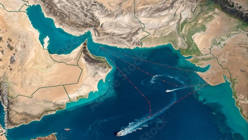
| 5 | 1.7981 | 1617872 | str_replace( $search = '{ITEM_DESCRIPTION}', $replace = NULL, $subject = '<div class="home_box">\n\t<div class="overlay-container">\n\t\t<a href="{ITEM_URL}"><img src="https://as2.ftcdn.net/v2/jpg/10/81/80/05/500_F_1081800595_KY4sO4LjC9RncwgViaIHH857qa4fnbco.jpg" alt="Aerial View of the Strategic Hormuz Strait Highlighted on a Detailed Map Illustrating Maritime Routes and Geopolitical Importance in the Middle East Region" class="home_preview" width=\'200\' height=\'112\' onMouseover="lightboxon(\'https://as2.ftcdn.net/v2/jpg/10/81/80/05/500_F_1081800595_KY4sO4LjC9RncwgViaIHH857qa4fnbco'... ) | ...\content_list_adobe.php:262 |
| ( ! ) Deprecated: str_replace(): Passing null to parameter #2 ($replace) of type array|string is deprecated in C:\wamp64\www\stockphotolk.com\members\content_list_adobe.php on line 171 | ||||
|---|---|---|---|---|
| Call Stack | ||||
| # | Time | Memory | Function | Location |
| 1 | 0.0001 | 363296 | {main}( ) | ...\index.php:0 |
| 2 | 0.0432 | 955880 | include( 'C:\wamp64\www\stockphotolk.com\members\content.php ) | ...\index.php:5 |
| 3 | 0.0486 | 1170472 | include( 'C:\wamp64\www\stockphotolk.com\members\content_list.php ) | ...\content.php:82 |
| 4 | 0.0627 | 1290544 | include( 'C:\wamp64\www\stockphotolk.com\members\content_list_adobe.php ) | ...\content_list.php:855 |
| 5 | 1.7998 | 1616976 | str_replace( $search = '{DOWNLOADS}', $replace = NULL, $subject = '<div class="home_box">\n\t<div class="overlay-container">\n\t\t<a href="{ITEM_URL}"><img src="{ITEM_IMG2}" alt="{ITEM_TITLE_FULL}" class="home_preview" {WIDTH} {HEIGHT} {ITEM_LIGHTBOX} style=\'{WIDTH2};{HEIGHT2}\'></a>\n\t</div>\n\t<div class="home_box_body">\n\t\t<a href="javascript:show_lightbox(1952127146,\'{SITE_ROOT}\')" title="{lang.add to favorite list}" class="home_box_heart"><i class="fa fa-heart-o"></i></a>\n\t\t<h6><a href="{ITEM_URL}">{ITEM_TITLE_FULL}</a></h6>\n\t\t<p class="small">{ITEM_DESCRIPTION}</p>\n\t\t<div cla'... ) | ...\content_list_adobe.php:171 |
| ( ! ) Deprecated: str_replace(): Passing null to parameter #2 ($replace) of type array|string is deprecated in C:\wamp64\www\stockphotolk.com\members\content_list_adobe.php on line 262 | ||||
|---|---|---|---|---|
| Call Stack | ||||
| # | Time | Memory | Function | Location |
| 1 | 0.0001 | 363296 | {main}( ) | ...\index.php:0 |
| 2 | 0.0432 | 955880 | include( 'C:\wamp64\www\stockphotolk.com\members\content.php ) | ...\index.php:5 |
| 3 | 0.0486 | 1170472 | include( 'C:\wamp64\www\stockphotolk.com\members\content_list.php ) | ...\content.php:82 |
| 4 | 0.0627 | 1290544 | include( 'C:\wamp64\www\stockphotolk.com\members\content_list_adobe.php ) | ...\content_list.php:855 |
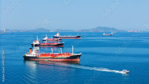
| 5 | 1.8012 | 1617872 | str_replace( $search = '{ITEM_DESCRIPTION}', $replace = NULL, $subject = '<div class="home_box">\n\t<div class="overlay-container">\n\t\t<a href="{ITEM_URL}"><img src="https://as2.ftcdn.net/v2/jpg/19/52/12/71/500_F_1952127146_BPr7Amm6xEiSbaHjtSVP3EEMj8QdOvh7.jpg" alt="LPG gas and oil tanker ships anchored in the ocean, with a fast patrol boat in the foreground. Global energy transport, war energy crisis, and Strait of Hormuz blockade concept." class="home_preview" width=\'200\' height=\'112\' onMouseover="lightboxon(\'https://as2.ftcdn.net/v2/jpg/19/52/12/71/500_F_1952127146_BPr7Amm6xE'... ) | ...\content_list_adobe.php:262 |
| ( ! ) Deprecated: str_replace(): Passing null to parameter #2 ($replace) of type array|string is deprecated in C:\wamp64\www\stockphotolk.com\members\content_list_adobe.php on line 171 | ||||
|---|---|---|---|---|
| Call Stack | ||||
| # | Time | Memory | Function | Location |
| 1 | 0.0001 | 363296 | {main}( ) | ...\index.php:0 |
| 2 | 0.0432 | 955880 | include( 'C:\wamp64\www\stockphotolk.com\members\content.php ) | ...\index.php:5 |
| 3 | 0.0486 | 1170472 | include( 'C:\wamp64\www\stockphotolk.com\members\content_list.php ) | ...\content.php:82 |
| 4 | 0.0627 | 1290544 | include( 'C:\wamp64\www\stockphotolk.com\members\content_list_adobe.php ) | ...\content_list.php:855 |
| 5 | 1.8031 | 1637456 | str_replace( $search = '{DOWNLOADS}', $replace = NULL, $subject = '<div class="home_box">\n\t<div class="overlay-container">\n\t\t<a href="{ITEM_URL}"><img src="{ITEM_IMG2}" alt="{ITEM_TITLE_FULL}" class="home_preview" {WIDTH} {HEIGHT} {ITEM_LIGHTBOX} style=\'{WIDTH2};{HEIGHT2}\'></a>\n\t</div>\n\t<div class="home_box_body">\n\t\t<a href="javascript:show_lightbox(334876603,\'{SITE_ROOT}\')" title="{lang.add to favorite list}" class="home_box_heart"><i class="fa fa-heart-o"></i></a>\n\t\t<h6><a href="{ITEM_URL}">{ITEM_TITLE_FULL}</a></h6>\n\t\t<p class="small">{ITEM_DESCRIPTION}</p>\n\t\t<div clas'... ) | ...\content_list_adobe.php:171 |
| ( ! ) Deprecated: str_replace(): Passing null to parameter #2 ($replace) of type array|string is deprecated in C:\wamp64\www\stockphotolk.com\members\content_list_adobe.php on line 262 | ||||
|---|---|---|---|---|
| Call Stack | ||||
| # | Time | Memory | Function | Location |
| 1 | 0.0001 | 363296 | {main}( ) | ...\index.php:0 |
| 2 | 0.0432 | 955880 | include( 'C:\wamp64\www\stockphotolk.com\members\content.php ) | ...\index.php:5 |
| 3 | 0.0486 | 1170472 | include( 'C:\wamp64\www\stockphotolk.com\members\content_list.php ) | ...\content.php:82 |
| 4 | 0.0627 | 1290544 | include( 'C:\wamp64\www\stockphotolk.com\members\content_list_adobe.php ) | ...\content_list.php:855 |
| 5 | 1.8044 | 1637904 | str_replace( $search = '{ITEM_DESCRIPTION}', $replace = NULL, $subject = '<div class="home_box">\n\t<div class="overlay-container">\n\t\t<a href="{ITEM_URL}"><img src="https://as1.ftcdn.net/v2/jpg/03/34/87/66/500_F_334876603_9iGdLRjVwmDDeg1DAJv434fnZO83JQpI.jpg" alt="Long shot of oil tankers and container cargo ships in the sea of Hormuz strait in Persian Gulf Iran" class="home_preview" width=\'200\' height=\'112\' onMouseover="lightboxon5(\'https://v.ftcdn.net/03/34/87/66/700_F_334876603_9iGdLRjVwmDDeg1DAJv434fnZO83JQpI_ST.mp4\',300,169,event,\'\');" onMouseout="lightboxoff();" onMousemo'... ) | ...\content_list_adobe.php:262 |
| ( ! ) Deprecated: str_replace(): Passing null to parameter #2 ($replace) of type array|string is deprecated in C:\wamp64\www\stockphotolk.com\members\content_list_adobe.php on line 171 | ||||
|---|---|---|---|---|
| Call Stack | ||||
| # | Time | Memory | Function | Location |
| 1 | 0.0001 | 363296 | {main}( ) | ...\index.php:0 |
| 2 | 0.0432 | 955880 | include( 'C:\wamp64\www\stockphotolk.com\members\content.php ) | ...\index.php:5 |
| 3 | 0.0486 | 1170472 | include( 'C:\wamp64\www\stockphotolk.com\members\content_list.php ) | ...\content.php:82 |
| 4 | 0.0627 | 1290544 | include( 'C:\wamp64\www\stockphotolk.com\members\content_list_adobe.php ) | ...\content_list.php:855 |
| 5 | 1.8061 | 1637264 | str_replace( $search = '{DOWNLOADS}', $replace = NULL, $subject = '<div class="home_box">\n\t<div class="overlay-container">\n\t\t<a href="{ITEM_URL}"><img src="{ITEM_IMG2}" alt="{ITEM_TITLE_FULL}" class="home_preview" {WIDTH} {HEIGHT} {ITEM_LIGHTBOX} style=\'{WIDTH2};{HEIGHT2}\'></a>\n\t</div>\n\t<div class="home_box_body">\n\t\t<a href="javascript:show_lightbox(1940296140,\'{SITE_ROOT}\')" title="{lang.add to favorite list}" class="home_box_heart"><i class="fa fa-heart-o"></i></a>\n\t\t<h6><a href="{ITEM_URL}">{ITEM_TITLE_FULL}</a></h6>\n\t\t<p class="small">{ITEM_DESCRIPTION}</p>\n\t\t<div cla'... ) | ...\content_list_adobe.php:171 |
| ( ! ) Deprecated: str_replace(): Passing null to parameter #2 ($replace) of type array|string is deprecated in C:\wamp64\www\stockphotolk.com\members\content_list_adobe.php on line 262 | ||||
|---|---|---|---|---|
| Call Stack | ||||
| # | Time | Memory | Function | Location |
| 1 | 0.0001 | 363296 | {main}( ) | ...\index.php:0 |
| 2 | 0.0432 | 955880 | include( 'C:\wamp64\www\stockphotolk.com\members\content.php ) | ...\index.php:5 |
| 3 | 0.0486 | 1170472 | include( 'C:\wamp64\www\stockphotolk.com\members\content_list.php ) | ...\content.php:82 |
| 4 | 0.0627 | 1290544 | include( 'C:\wamp64\www\stockphotolk.com\members\content_list_adobe.php ) | ...\content_list.php:855 |
| 5 | 1.8077 | 1638352 | str_replace( $search = '{ITEM_DESCRIPTION}', $replace = NULL, $subject = '<div class="home_box">\n\t<div class="overlay-container">\n\t\t<a href="{ITEM_URL}"><img src="https://as2.ftcdn.net/v2/jpg/19/40/29/61/500_F_1940296140_LSK8SqXr8CAcvxJzN17CniYoAYwMk7m8.jpg" alt="Magnifying glass focusing on Strait of Hormuz on paper map with Iran background conceptualizing detailed geopolitical analysis of middle east energy corridors and shipping lanes" class="home_preview" width=\'200\' height=\'112\' onMouseover="lightboxon(\'https://as2.ftcdn.net/v2/jpg/19/40/29/61/500_F_1940296140_LSK8SqXr8C'... ) | ...\content_list_adobe.php:262 |
| ( ! ) Deprecated: str_replace(): Passing null to parameter #2 ($replace) of type array|string is deprecated in C:\wamp64\www\stockphotolk.com\members\content_list_adobe.php on line 171 | ||||
|---|---|---|---|---|
| Call Stack | ||||
| # | Time | Memory | Function | Location |
| 1 | 0.0001 | 363296 | {main}( ) | ...\index.php:0 |
| 2 | 0.0432 | 955880 | include( 'C:\wamp64\www\stockphotolk.com\members\content.php ) | ...\index.php:5 |
| 3 | 0.0486 | 1170472 | include( 'C:\wamp64\www\stockphotolk.com\members\content_list.php ) | ...\content.php:82 |
| 4 | 0.0627 | 1290544 | include( 'C:\wamp64\www\stockphotolk.com\members\content_list_adobe.php ) | ...\content_list.php:855 |
| 5 | 1.8094 | 1653840 | str_replace( $search = '{DOWNLOADS}', $replace = NULL, $subject = '<div class="home_box">\n\t<div class="overlay-container">\n\t\t<a href="{ITEM_URL}"><img src="{ITEM_IMG2}" alt="{ITEM_TITLE_FULL}" class="home_preview" {WIDTH} {HEIGHT} {ITEM_LIGHTBOX} style=\'{WIDTH2};{HEIGHT2}\'></a>\n\t</div>\n\t<div class="home_box_body">\n\t\t<a href="javascript:show_lightbox(1945605470,\'{SITE_ROOT}\')" title="{lang.add to favorite list}" class="home_box_heart"><i class="fa fa-heart-o"></i></a>\n\t\t<h6><a href="{ITEM_URL}">{ITEM_TITLE_FULL}</a></h6>\n\t\t<p class="small">{ITEM_DESCRIPTION}</p>\n\t\t<div cla'... ) | ...\content_list_adobe.php:171 |
| ( ! ) Deprecated: str_replace(): Passing null to parameter #2 ($replace) of type array|string is deprecated in C:\wamp64\www\stockphotolk.com\members\content_list_adobe.php on line 262 | ||||
|---|---|---|---|---|
| Call Stack | ||||
| # | Time | Memory | Function | Location |
| 1 | 0.0001 | 363296 | {main}( ) | ...\index.php:0 |
| 2 | 0.0432 | 955880 | include( 'C:\wamp64\www\stockphotolk.com\members\content.php ) | ...\index.php:5 |
| 3 | 0.0486 | 1170472 | include( 'C:\wamp64\www\stockphotolk.com\members\content_list.php ) | ...\content.php:82 |
| 4 | 0.0627 | 1290544 | include( 'C:\wamp64\www\stockphotolk.com\members\content_list_adobe.php ) | ...\content_list.php:855 |
| 5 | 1.8106 | 1654736 | str_replace( $search = '{ITEM_DESCRIPTION}', $replace = NULL, $subject = '<div class="home_box">\n\t<div class="overlay-container">\n\t\t<a href="{ITEM_URL}"><img src="https://as1.ftcdn.net/v2/jpg/19/45/60/54/500_F_1945605470_aOmdUBM0ktI6g0oFphJYQAlQipkBHRqS.jpg" alt="Old rusty metal valve on industrial pipe with background map of Iran and strait of Hormuz symbolizing global oil supply security energy crisis and geopolitical tensions in region today" class="home_preview" width=\'200\' height=\'112\' onMouseover="lightboxon(\'https://as1.ftcdn.net/v2/jpg/19/45/60/54/500_F_1945605470_aOm'... ) | ...\content_list_adobe.php:262 |
| ( ! ) Deprecated: str_replace(): Passing null to parameter #2 ($replace) of type array|string is deprecated in C:\wamp64\www\stockphotolk.com\members\content_list_adobe.php on line 171 | ||||
|---|---|---|---|---|
| Call Stack | ||||
| # | Time | Memory | Function | Location |
| 1 | 0.0001 | 363296 | {main}( ) | ...\index.php:0 |
| 2 | 0.0432 | 955880 | include( 'C:\wamp64\www\stockphotolk.com\members\content.php ) | ...\index.php:5 |
| 3 | 0.0486 | 1170472 | include( 'C:\wamp64\www\stockphotolk.com\members\content_list.php ) | ...\content.php:82 |
| 4 | 0.0627 | 1290544 | include( 'C:\wamp64\www\stockphotolk.com\members\content_list_adobe.php ) | ...\content_list.php:855 |
| 5 | 1.8125 | 1657936 | str_replace( $search = '{DOWNLOADS}', $replace = NULL, $subject = '<div class="home_box">\n\t<div class="overlay-container">\n\t\t<a href="{ITEM_URL}"><img src="{ITEM_IMG2}" alt="{ITEM_TITLE_FULL}" class="home_preview" {WIDTH} {HEIGHT} {ITEM_LIGHTBOX} style=\'{WIDTH2};{HEIGHT2}\'></a>\n\t</div>\n\t<div class="home_box_body">\n\t\t<a href="javascript:show_lightbox(1944413240,\'{SITE_ROOT}\')" title="{lang.add to favorite list}" class="home_box_heart"><i class="fa fa-heart-o"></i></a>\n\t\t<h6><a href="{ITEM_URL}">{ITEM_TITLE_FULL}</a></h6>\n\t\t<p class="small">{ITEM_DESCRIPTION}</p>\n\t\t<div cla'... ) | ...\content_list_adobe.php:171 |
| ( ! ) Deprecated: str_replace(): Passing null to parameter #2 ($replace) of type array|string is deprecated in C:\wamp64\www\stockphotolk.com\members\content_list_adobe.php on line 262 | ||||
|---|---|---|---|---|
| Call Stack | ||||
| # | Time | Memory | Function | Location |
| 1 | 0.0001 | 363296 | {main}( ) | ...\index.php:0 |
| 2 | 0.0432 | 955880 | include( 'C:\wamp64\www\stockphotolk.com\members\content.php ) | ...\index.php:5 |
| 3 | 0.0486 | 1170472 | include( 'C:\wamp64\www\stockphotolk.com\members\content_list.php ) | ...\content.php:82 |
| 4 | 0.0627 | 1290544 | include( 'C:\wamp64\www\stockphotolk.com\members\content_list_adobe.php ) | ...\content_list.php:855 |
| 5 | 1.8139 | 1658512 | str_replace( $search = '{ITEM_DESCRIPTION}', $replace = NULL, $subject = '<div class="home_box">\n\t<div class="overlay-container">\n\t\t<a href="{ITEM_URL}"><img src="https://as1.ftcdn.net/v2/jpg/19/44/41/32/500_F_1944413240_S5eO4n9BRZTDg1iVj0NdzQ8nXGxW0D7z.jpg" alt="Detailed Persian Gulf and Strait of Hormuz Geopolitical 3d Map in White Background" class="home_preview" width=\'200\' height=\'112\' onMouseover="lightboxon(\'https://as1.ftcdn.net/v2/jpg/19/44/41/32/500_F_1944413240_S5eO4n9BRZTDg1iVj0NdzQ8nXGxW0D7z.jpg\',400,223,event,\'\',\'Detailed Persian Gulf and Strait of Hormuz Geopol'... ) | ...\content_list_adobe.php:262 |
| ( ! ) Deprecated: str_replace(): Passing null to parameter #2 ($replace) of type array|string is deprecated in C:\wamp64\www\stockphotolk.com\members\content_list_adobe.php on line 171 | ||||
|---|---|---|---|---|
| Call Stack | ||||
| # | Time | Memory | Function | Location |
| 1 | 0.0001 | 363296 | {main}( ) | ...\index.php:0 |
| 2 | 0.0432 | 955880 | include( 'C:\wamp64\www\stockphotolk.com\members\content.php ) | ...\index.php:5 |
| 3 | 0.0486 | 1170472 | include( 'C:\wamp64\www\stockphotolk.com\members\content_list.php ) | ...\content.php:82 |
| 4 | 0.0627 | 1290544 | include( 'C:\wamp64\www\stockphotolk.com\members\content_list_adobe.php ) | ...\content_list.php:855 |
| 5 | 1.8155 | 1657872 | str_replace( $search = '{DOWNLOADS}', $replace = NULL, $subject = '<div class="home_box">\n\t<div class="overlay-container">\n\t\t<a href="{ITEM_URL}"><img src="{ITEM_IMG2}" alt="{ITEM_TITLE_FULL}" class="home_preview" {WIDTH} {HEIGHT} {ITEM_LIGHTBOX} style=\'{WIDTH2};{HEIGHT2}\'></a>\n\t</div>\n\t<div class="home_box_body">\n\t\t<a href="javascript:show_lightbox(721098146,\'{SITE_ROOT}\')" title="{lang.add to favorite list}" class="home_box_heart"><i class="fa fa-heart-o"></i></a>\n\t\t<h6><a href="{ITEM_URL}">{ITEM_TITLE_FULL}</a></h6>\n\t\t<p class="small">{ITEM_DESCRIPTION}</p>\n\t\t<div clas'... ) | ...\content_list_adobe.php:171 |
| ( ! ) Deprecated: str_replace(): Passing null to parameter #2 ($replace) of type array|string is deprecated in C:\wamp64\www\stockphotolk.com\members\content_list_adobe.php on line 262 | ||||
|---|---|---|---|---|
| Call Stack | ||||
| # | Time | Memory | Function | Location |
| 1 | 0.0001 | 363296 | {main}( ) | ...\index.php:0 |
| 2 | 0.0432 | 955880 | include( 'C:\wamp64\www\stockphotolk.com\members\content.php ) | ...\index.php:5 |
| 3 | 0.0486 | 1170472 | include( 'C:\wamp64\www\stockphotolk.com\members\content_list.php ) | ...\content.php:82 |
| 4 | 0.0627 | 1290544 | include( 'C:\wamp64\www\stockphotolk.com\members\content_list_adobe.php ) | ...\content_list.php:855 |
| 5 | 1.8170 | 1675216 | str_replace( $search = '{ITEM_DESCRIPTION}', $replace = NULL, $subject = '<div class="home_box">\n\t<div class="overlay-container">\n\t\t<a href="{ITEM_URL}"><img src="https://as2.ftcdn.net/v2/jpg/07/21/09/81/500_F_721098146_jWje78HkgPDGTvBxmqvzz2dr2bzdiHsr.jpg" alt="unrecognizable ship, an oil tanker sailing through Red Sea along coast of Yemen. transportation of goods important for global economy by sea" class="home_preview" width=\'200\' height=\'133\' onMouseover="lightboxon(\'https://as2.ftcdn.net/v2/jpg/07/21/09/81/500_F_721098146_jWje78HkgPDGTvBxmqvzz2dr2bzdiHsr.jpg\',400,266,eve'... ) | ...\content_list_adobe.php:262 |